


custom text 2
DEFINITION
Meeting current needs without compromising the ability of future generations to meet their own needs, ensuring a balance between economic growth, environmental protection, and social well-being (this is known as the Triple Bottom Line of Sustainability)
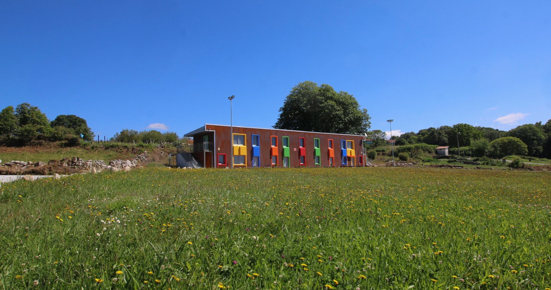
Celtainer is a project that, from its inception, has believed in sustainability, divided into three levels: Construction, Energy, and Environment.
Our constructive values
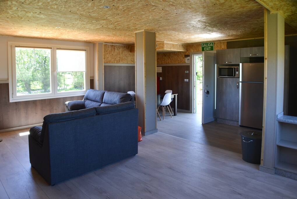
We have self-built the tourist apartments, using reused shipping containers, in order to give them a second life.
In terms of insulation, we try to create practically passive apartments, investing heavily in insulation, with different levels and layers. Inside, we have mostly used recycled OSB wood and decking, in order to reuse as many materials as possible.
Energetic
Thanks to the excellent thermal insulation, the energy used to heat the apartments is significantly lower compared to a traditional building. To heat the apartments and domestic hot water, we used aerothermal energy, a clean technology that extracts up to 77% of its energy from the air for free.
Aerothermal systems are state-of-the-art heat pumps designed to provide cooling in summer, heating in winter and, if desired, hot water all year round.
We have installed 16 solar panels that provide a power of almost 9,000 W
Environmental
We must acknowledge that for many household uses, the quality of drinking water isn't necessary. For example, we use around 40 liters of drinking water daily in the toilet. That's why we decided to collect rainwater and install a separate system that allows us to store rainwater in the cistern. It makes no sense to use drinking water for the toilet.
The water tanks used to meet these needs are repurposed from the food industry, giving them a new life.
Another aspect that is very important to us is the reduction of plastics, which is why we wanted to offer our customers a plastic-free experience. This includes even using metal cleaning utensils such as mop buckets.
All bed linen and bathroom furnishings are made of natural cotton fibers.
Let's take care of the environment
Celtainer has been recognized at the KAYAK Travel Awards 2022 and 2023.
The award is based on guest reviews, so we want to give a special thanks to our guests.
#KAYAKTravelAwards


Our Offers
Experiencias
Hiking trails
Hiking (or trekking if practiced in the mountains), is an aerobic activity that benefits our circulatory system. By hiking we strengthen our heart, this helps us prevent possible heart disease and keep our blood pressure at optimal values.
In this area there are innumerable trails.
Camino Real
DISTANCE: 5 Km by car 7 minutes ROUTE: 9 Km circular DURATION: 2,30 hours
UPHILL SLOPE: 358 m DOWNHILL SLOPE: 358 m
MINIMUM ALTITUDE: 416 m MAXIMUM ALTITUDE: 814 m
DIFFICULTY– Moderate
http://gl.wikiloc.com/rutas-sendeirismo/pr-g4-camino-real-de-san-pedro-de-rocas-esgos-ourense-8597135Route mina de Baldrei
DISTANCE: 12 Km by car ROUTE: 1,07 Km circular DURATION: 8 minutes
UPHILL SLOPE: 129 m DOWNHILL SLOPE: 16 m
MINIMUM ALTITUDE: 732 m MAXIMUM ALTITUDE: 861 m
DIFFICULTY– Minimum COORDINATES: +42.291873 -7.599544
https://gl.wikiloc.com/rutas-sendeirismo/ruta-mina-de-baldrei-maceda-ourense-15014028
Route Os Penedos da Moura
ROUTE: 18 Km Depart from the flats on foot and it is circular DURATION: 3,30 hours
UPHILL SLOPE: 322 m DOWNHILL SLOPE: 322 m
MINIMUM ALTITUDE: 581 m MAXIMUM ALTITUDE: 834 m
DIFFICULTY– Moderate
https://gl.wikiloc.com/rutas-sendeirismo/penedos-da-moura-maceda-36117234
Route Dos Muiños - Esgos
DISTANCE: 6 Km by car 8 minutes ROUTE: 15,03 Km circular DURATION: 4,30 hours
UPHILL SLOPE: 167 m DOWNHILL SLOPE: 167 m
MINIMUM ALTITUDE: 424 m MAXIMUM ALTITUDE: 571 m
DIFFICULTY– Minimum COORDINATES: 42.320984 -7.707874